

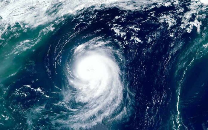
A fast-moving tropical storm is set to strike Japan’s eastern heartland tonight, bringing dangerous wind and flooding to millions.
Story Highlights
- Japan’s Kanto region, including areas north of Tokyo, is in the forecast landfall zone Tuesday night.
- Live trackers show Chan-hom nearing Ibaraki Prefecture with landfall expected within hours.
- Forecasters report sustained winds near 60 miles per hour with higher gusts.
- Experts stress the threat is regional, not a single city “dot” on the map.
Storm Track: Landfall Aimed at Northern Kanto
Japan’s national and international forecasters say Tropical Storm Chan-hom is closing in on eastern Honshu and is expected to make landfall Tuesday night in or near Ibaraki Prefecture, north of Tokyo. The Japan Times summarizes guidance calling for landfall in the northern Kanto region between late Tuesday and early Wednesday, with strong wind and heavy rain likely across broad areas. The real-world impact zone covers multiple prefectures, not just one town, as the center pushes inland and weakens over terrain.
Real-time maps place the storm just offshore and tracking west toward the Pacific coast of Kanto, with an onshore push expected within about 12 hours. The live tracker flags Ibaraki as the most likely initial point, followed by a westward move across central Honshu that should steadily reduce wind strength but spread heavy rain across valleys and urban basins. The largest population centers near Tokyo remain at risk of power outages, downed trees, urban flooding, and transit delays as outer rain bands sweep inland.
Intensity: Strong Tropical Storm Winds and Dangerous Gusts
Forecasts indicate maximum sustained winds around 60 miles per hour with gusts near 75 miles per hour as Chan-hom nears the coast. That wind range can snap limbs, topple shallow-rooted trees, and scatter unsecured debris. Rain poses the broader hazard across concrete-heavy metro corridors. Brief tornado-like spin-ups in outer bands are possible in any landfalling tropical system, though forecasters have focused mainly on wind, rain, and surf. Mountain slopes west of Kanto face landslide risks as saturated soils loosen.
Public and private guidance agrees the system should weaken quickly after landfall, but that does not remove the flooding threat. Slow-moving rain bands and blocked drainage can flood low streets, underpasses, and rail approaches. Coastal areas on the Pacific side should expect high surf, minor surge, and rip currents. Even as winds ease inland, swollen streams can rise for hours. Commuters should plan for delays and check local alerts before leaving home or work during the overnight and early morning window.
Forecast “Cone vs. Dot”: Read the Whole Risk Area
Several outlets mention a single landfall point, such as Tsukuba or a spot north of Tokyo, but the broader guidance has consistently framed the target as eastern Japan’s Kanto corridor, including Ibaraki and nearby prefectures. The live mapping consensus highlights Ibaraki for the first strike, yet emphasizes a regional swath of wind and rain hazards. This is the classic forecast problem where complex storm paths get simplified into one city, even as the actual risk spreads across several million people and many counties.
Tropical Storm Chan-hom is approaching southeast #Honshu, #Japan with heavy rain bring the main threat. pic.twitter.com/CfJKyYHsN6
— Jason Nicholls 💙 (@jnmet) August 11, 2026
A U.S. military community tracker likewise points toward landfall just north of Tokyo, aligning with the same general corridor that Japan-based outlets have flagged. That harmony across sources builds confidence in the overnight timing and the northern Kanto focus, even if the exact dot wobbles near the coast. Residents across the Kanto plain should prepare as if the center could jog tens of miles before crossing the shoreline, which can shift peak wind zones while leaving the rain threat intact.
What To Expect Tonight: Practical Safety Steps
Residents should secure outdoor items, charge phones and flashlights, and avoid travel during peak wind and rain. Drivers should stay off flooded roads and never pass barricades. Families should move cars from low garages and clear storm drains where safe. If you live near slopes, prepare a go-bag in case of a landslide warning. Coastal anglers and surfers should stand down until seas calm. Authorities will push alerts as the center nears land; heed evacuation or shelter advice quickly.
Air and rail services may slow or pause, especially on lines exposed to crosswinds or landslide-prone cuts. Power companies often stage crews before landfall; brief outages are possible as trees meet lines. Schools and businesses may shift schedules on short notice to protect commuters. The storm should weaken inland, but morning cleanup can still be risky. Treat fallen lines as live, and keep generators outside to prevent carbon monoxide poisoning. Common-sense steps taken now prevent injuries later.
Bottom Line: A Manageable but Serious Hit
Chan-hom is not forecast to be a historic super typhoon, but it is strong enough to cause real damage in crowded cities and small towns alike. The core message from Japanese and international trackers is clear: prepare for a regional impact across northern Kanto tonight, not just a single city strike. Expect improving conditions by Wednesday as the system weakens over land, but give rivers and hills time to settle. Stay weather-aware, respect local orders, and look out for neighbors.
Sources:
zoom.earth, stripes.com, japantimes.co.jp, accuweather.com