

New Jersey’s governor declared a state of emergency for eight coastal counties as a nor’easter slammed the Shore with flooding, outages, and dangerous surf.
Story Snapshot
- The state emergency covered eight counties with coastal and back-bay flooding risks.
- Reporters documented flooded streets and a water rescue in Seabright during the storm.
- Utilities reported tens of thousands without power at points on Saturday morning.
- High tides, a full moon, and onshore winds drove repeated inundation along the coast.
Emergency Order Targets Highest-Risk Shore Counties
New Jersey Governor Mikie Sherrill declared a state of emergency for eight counties as the storm moved in late Friday. The order named Atlantic, Burlington, Cape May, Cumberland, Middlesex, Monmouth, Ocean, and Salem counties, and set a 5 p.m. effective time to stage resources and limit travel in danger zones. State messaging warned of strong winds, heavy rain, and significant coastal flooding with the worst impacts from Friday night through Sunday, including hazardous conditions away from the beaches.
Officials pointed to tide timing and onshore flow as key drivers of risk. Live updates from national and local outlets flagged repeated high-tide cycles, a full moon that lifts water levels, and pounding surf along barrier islands. Reports cited waves near 14 feet off Barnegat and back-bay flooding as winds pushed water into low spots again and again. These mechanics match long-known patterns for nor’easters at the Jersey Shore, which often bring erosion and saltwater on roads.
Flooding Hits Seabright, Barrier Islands, And Coastal Roads
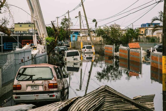
Field crews documented street flooding in several towns as the storm peaked. An ABC7NY journalist reported from Seabright that a parking lot and nearby street were under water. At least one car was stranded, and local firefighters rescued a woman and her dog from a flooded vehicle. Live storm coverage also identified flooding in Manasquan, parts of Long Beach Island, and Atlantic City, with roads submerged and heavy waves rolling over dunes and into bayside neighborhoods.
Water rose fastest around high tide, and then receded before returning with the next cycle. That pattern created repeat disruptions for drivers, small businesses, and first responders. Some areas saw “moderate” flooding while others faced deeper water and road closures, reflecting how wind direction, inlet shape, and dune health can change outcomes town to town. Early reports focused on shoreline scenes; fuller municipal damage summaries typically arrive later from local agencies.
Power Outages Surge As Winds Knock Down Lines
Utility dashboards showed thousands without electricity during the worst of the nor’easter. By late Friday night and into Saturday morning, live reports tallied widespread outages across New Jersey. One Saturday snapshot listed more than 21,000 outages at Jersey Central Power and Light, with additional customers out at Public Service Electric and Gas and Atlantic City Electric. Earlier and later figures varied as wind gusts and repairs rose and fell with the storm’s bands.
4 AM Top-of-the-Hour News
Downed trees and power lines. 150 thousand in the dark from Pennsylvania to Rhode Island. Hundreds of flights cancelled. A Nor-Easter slamming coastal areas from New Jersey to New England. New York. People stunned by the rough seas that spilled into the… pic.twitter.com/7kQPELSre9
— Worldwide News Network (@WorldwideNNX) September 27, 2026
Crews prioritized downed lines and hazard calls while advising residents to avoid floodwater and treat all wires as live. Outages tended to cluster in coastal counties that also saw the worst flooding, compounding the risk for seniors and families. The state’s emergency order enabled quicker coordination with county emergency managers and local utilities to move assets, close roads, and support rescues as the weather continued through the weekend.
What Coastal Residents Should Watch Next
Residents along bays and inlets faced the most persistent water rise because wind pushed tides into back channels. Officials urged people to monitor tide times, obey barricades, and never drive through water. The nor’easter threat continued into Sunday with onshore winds and rough surf, meaning more erosion and debris on roadways. Flood advisories and warnings were active across the Shore, and forecasters signaled that each high tide could bring a new round of problems until winds eased.
Sources:
feedpress.me, foxweather.com, newjersey.news12.com, patch.com, nj.gov